A tropical cyclone named Trudy-26 is active over the Atlantic side of Mexico today, October 13, 2026, and has been classified as an Orange alert by GDACS, the European Union’s Global Disaster Alert and Coordination System. Maximum sustained winds have been estimated at up to 213 km/h (about 132 mph) — well above the 120 km/h threshold for hurricane-strength winds.
According to the alert data, roughly 22,500 people are estimated to be exposed to winds of 120 km/h or higher. Mexico’s overall vulnerability for this event is rated Medium, meaning significant impacts are possible but the country has established infrastructure and response capacity to cope.
What residents and travelers may notice
People in affected coastal and near-coastal areas should expect damaging winds, heavy rain, localized flooding, power outages, and downed trees or power lines. Roads may be blocked by debris or washouts, and flight or ferry cancellations along the affected coast are likely. Coastal zones may also see storm surge and large, dangerous waves.
Practical pointers:
1. Stay indoors away from windows during the strongest winds, and avoid coastal areas, rivers, and low-lying spots prone to flash flooding.
2. Charge phones and keep flashlights, drinking water, and any needed medications within easy reach in case of power cuts.
3. Follow instructions from Mexico’s civil protection authorities (Protección Civil) and check official forecasts before traveling in the region over the next 24–48 hours.
This alert is based on data from GDACS (the EU Joint Research Centre’s Global Disaster Alert and Coordination System), with cyclone tracking supported by NOAA and Mexico’s National Weather Service (SMN).
Frequently Asked Questions
Is Trudy-26 a hurricane?
With maximum winds estimated at 213 km/h (132 mph), it meets hurricane-strength criteria (119 km/h or higher), though the alert data currently labels it a tropical storm. Either way, damaging winds are expected in affected areas.
Which areas are most at risk?
The cyclone is active over the Atlantic side of Mexico, so coastal communities along the Gulf or Caribbean-facing coast are most exposed. An estimated 22,500 people are in the zone experiencing winds of 120 km/h or higher.
Should I evacuate?
Follow guidance from Mexico's Protección Civil and local authorities — they issue evacuation orders based on local conditions. If you are in a low-lying or flood-prone area, be ready to move to higher ground on short notice.
How long will this last?
The current alert window is for October 13, 2026, but heavy rain and flooding can linger a day or two after the strongest winds pass. Keep monitoring official forecasts until authorities give the all-clear.
Keep tracking this:
Source: GDACS (EU Joint Research Centre)

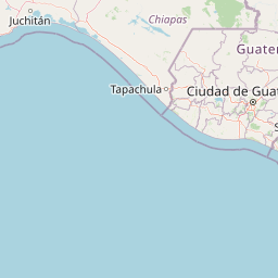





Map centered on the epicenter (10.60, -96.50). Map data © OpenStreetMap contributors.
Sky & Solar Conditions at the Time
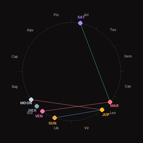
Moon: Waxing Crescent (9% illuminated), in Scorpio.
Notable planetary angles: Sun sextile Jupiter (59°), Mars trine Saturn (118°), Venus square Mars (88°), Moon square Jupiter (94°).
Concurrent space weather: planetary Kp index 2.3; strongest recent solar flare: nothing notable.
This is a factual snapshot, not a claim of cause and effect – researchers are divided on whether lunar, planetary or solar factors influence seismic or weather activity. It’s included so readers can track the pattern for themselves over time.