A tropical cyclone named POLO-26 has strengthened to hurricane force in the Eastern Pacific and is being tracked as a potential threat to Mexico. The storm was active from September 21 through September 28, 2026, with maximum sustained winds reaching 287 km/h (about 178 mph) at its peak — well above the 119 km/h (74 mph) threshold that defines a hurricane. The Global Disaster Alert and Coordination System (GDACS) has classified this event as an Orange alert, its second-highest level, indicating a potentially significant impact that warrants close monitoring.
Based on current tracking, an estimated 195,000 people in Mexico could experience winds of at least 120 km/h (Category 1 strength) or higher. Mexico’s assessed vulnerability for this event is rated as Medium, meaning some infrastructure, power, and transport disruption is plausible in affected coastal and inland areas.
What residents and travelers might notice
Communities in the storm’s path should expect heavy rain, strong gusty winds, high surf, and the possibility of flash flooding or mudslides, especially in hilly or low-lying terrain. Coastal residents may see dangerous rip currents and storm surge. Airports, ferry services, and highways near the affected coastline could face delays or temporary closures, and localized power outages are possible as winds bring down trees and lines.
If you live in or are traveling through the affected region, now is the time to take practical steps: monitor official bulletins from Mexico’s National Meteorological Service and civil protection authorities; secure outdoor objects, charge phones, and stock a few days of water and food; and know your local evacuation route if you are in a flood- or surge-prone zone. Avoid driving through flooded roads — even shallow moving water can sweep a vehicle away. Mariners and beachgoers should stay off the water until the storm passes.
Cyclones in the Eastern Pacific typically weaken as they move over cooler water or make landfall, but heavy rainfall can persist well after the winds die down, so flooding risk may continue for a day or more after peak intensity. Data for this alert comes from GDACS (the EU Joint Research Centre’s Global Disaster Alert and Coordination System), which uses NOAA and national meteorological agency storm tracking.
Frequently Asked Questions
How strong is POLO-26 right now?
At its peak the storm reached maximum sustained winds of 287 km/h (about 178 mph), making it a powerful major hurricane. Strength fluctuates as the storm moves, so check the latest official advisories for current intensity.
Is anyone in Mexico directly in the storm's path?
An estimated 195,000 people in Mexico could experience Category 1-force winds (120 km/h or higher). The affected zone is concentrated along and near the coast under the storm's track.
Should I cancel my trip to the Mexican coast?
If your destination is in the alert area during September 21–28, 2026, contact your airline or hotel about rebooking, as flight and ferry disruptions are likely. Follow Mexican civil protection guidance for the specific state you plan to visit.
What should I do if I'm already in the affected area?
Secure loose outdoor items, stock up on water and essentials, charge devices, and stay indoors away from windows during the strongest winds. Avoid flooded roads and follow any evacuation orders from local authorities.
Keep tracking this:
Source: GDACS (EU Joint Research Centre)
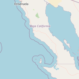
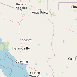





Map centered on the epicenter (25.00, -113.00). Map data © OpenStreetMap contributors.
Sky & Solar Conditions at the Time
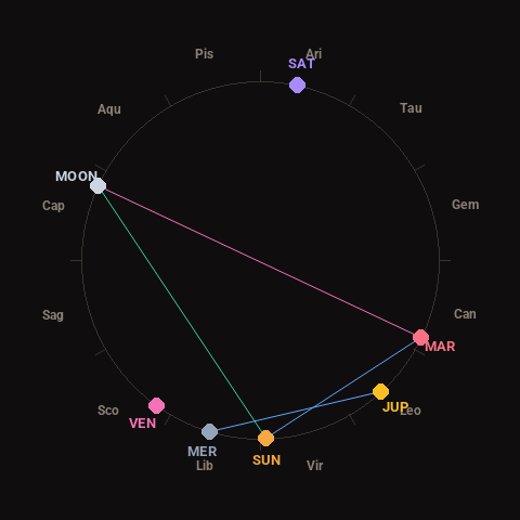
Moon: Waxing Gibbous (73% illuminated), in Capricorn.
Notable planetary angles: Moon opposite Mars (179°), Mercury sextile Jupiter (59°), Sun sextile Mars (62°), Sun trine Moon (117°).
Concurrent space weather: planetary Kp index 1.0; strongest recent solar flare: nothing notable.
This is a factual snapshot, not a claim of cause and effect – researchers are divided on whether lunar, planetary or solar factors influence seismic or weather activity. It’s included so readers can track the pattern for themselves over time.