A powerful tropical cyclone named POLO-26 has been active in the Eastern Pacific from September 21 through September 29, 2026, prompting a Red alert from the Global Disaster Alert and Coordination System (GDACS), the European Union’s disaster monitoring service. At its peak, the storm packed maximum sustained winds of 287 km/h (about 178 mph) — well above the 119 km/h (74 mph) threshold that defines a hurricane, and strong enough to fall into the highest categories on the hurricane scale.
According to GDACS estimates, roughly 222,000 people in Mexico are within the zone experiencing Category 1 wind speeds (120 km/h) or higher. Mexico’s overall vulnerability is rated Medium, reflecting both its exposure to Pacific hurricanes and its existing emergency-response capacity. Even when a hurricane’s center stays offshore or makes landfall in a sparsely populated stretch of coast, its rain bands can reach far inland.
What residents and travelers may notice
People in affected coastal and inland areas can expect destructive winds, torrential rainfall, flash flooding, and dangerous surf with high waves and rip currents. Landslides and mudslides are a serious risk in mountainous regions of western and southern Mexico, where saturated hillsides can give way hours or even days after the heaviest rain. Power outages, blocked roads, downed trees, and disruptions to flights and ferry services are likely in the hardest-hit zones.
Practical pointers for those in or near the affected area:
1. Follow instructions from Mexico’s civil protection authorities (Protección Civil) and local officials, including any evacuation orders for low-lying or coastal communities.
2. Prepare a basic kit with drinking water, non-perishable food, flashlights, batteries, medications, and charged phones or power banks, and fill vehicle fuel tanks early.
3. Avoid driving through flooded roads — even shallow, fast-moving water can sweep a vehicle away — and stay well clear of the shoreline until authorities declare conditions safe.
If you have travel planned to Mexico’s Pacific coast during this period, check with your airline or tour operator for schedule changes before heading to the airport. This alert is based on data from GDACS, the EU Joint Research Centre’s Global Disaster Alert and Coordination System, which tracks tropical cyclones using international meteorological sources.
Frequently Asked Questions
How strong is Hurricane POLO-26?
At peak intensity, maximum sustained winds reached 287 km/h (about 178 mph) — far above the 74 mph hurricane threshold, making it an extremely powerful storm during its active period from September 21–29, 2026.
How many people in Mexico are affected?
GDACS estimates about 222,000 people are experiencing Category 1 wind speeds (120 km/h) or higher. Many more could see heavy rain, flooding, and power outages well outside the core wind zone.
What are the biggest dangers from this storm?
The main hazards are destructive winds, flash flooding, dangerous surf, and mudslides in mountainous terrain. Flooding and landslides can remain a threat even after the strongest winds have passed.
I'm traveling to Mexico's Pacific coast — should I change my plans?
Check directly with your airline, hotel, or tour operator, as flights and road travel in affected areas may be disrupted during the alert window. Follow guidance from local civil protection authorities if you are already in the region.
Keep tracking this:
Source: GDACS (EU Joint Research Centre)
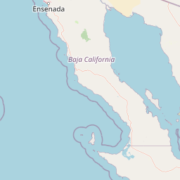
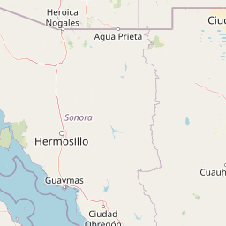

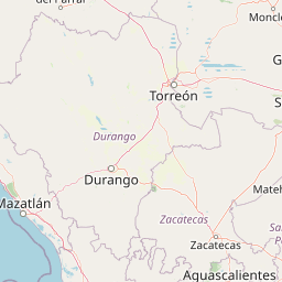

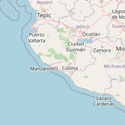
Map centered on the epicenter (25.90, -112.50). Map data © OpenStreetMap contributors.
Sky & Solar Conditions at the Time
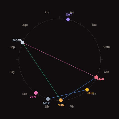
Moon: Waxing Gibbous (73% illuminated), in Capricorn.
Notable planetary angles: Moon opposite Mars (179°), Mercury sextile Jupiter (59°), Sun sextile Mars (62°), Sun trine Moon (117°).
Concurrent space weather: planetary Kp index 2.0; strongest recent solar flare: nothing notable.
This is a factual snapshot, not a claim of cause and effect – researchers are divided on whether lunar, planetary or solar factors influence seismic or weather activity. It’s included so readers can track the pattern for themselves over time.