A magnitude 6.9 earthquake struck 76 kilometers northeast of Ozernovskiy, on Russia’s Kamchatka Peninsula, at a depth of roughly 143 kilometers, according to the USGS. Because the quake originated so far below the surface, its energy was spread over a wide area and surface shaking was likely moderate rather than severe, even close to the epicenter.
The nearest major population center is Petropavlovsk-Kamchatsky, home to about 180,000 people, roughly 147 kilometers from the epicenter. Residents there and in smaller settlements along the peninsula’s eastern coast may have felt noticeable shaking — the kind that rattles dishes, swings light fixtures, and wakes sleepers — but widespread structural damage is less likely with a quake this deep. That said, magnitude 6.9 is a significant event, and damage to older or vulnerable buildings near the epicenter cannot be ruled out until local reports come in.
Kamchatka is one of the most seismically active regions on Earth, sitting where the Pacific Plate dives beneath the Okhotsk Plate. This is at least the 111th earthquake of magnitude 5.0 or greater recorded within about 300 kilometers of this spot in the past year, so strong shaking here is a known and recurring hazard rather than a surprise.
What to watch for
First, monitor local Russian and regional authorities for damage reports from coastal communities near Ozernovskiy. Second, aftershocks are expected after any quake of this size — some could be strong enough to feel in Petropavlovsk-Kamchatsky, so residents should secure loose items and check gas lines and chimneys for damage. Third, while deep quakes rarely generate tsunamis, anyone on the coast should stay alert to official tsunami messaging and know their nearest high ground.
Earthquake data and location details come from the USGS, the standard source for global earthquake reporting.
Frequently Asked Questions
Was this earthquake felt in Petropavlovsk-Kamchatsky?
Most likely yes. At roughly 147 kilometers away, a magnitude 6.9 quake is typically felt in a city that size even at depth, though shaking there would be moderate rather than violent.
Is a tsunami possible from this quake?
It's unlikely. Tsunamis are usually generated by shallow underwater quakes, and this one occurred 143 kilometers deep. Still, coastal residents should follow official local advisories rather than assumptions.
Are aftershocks likely?
Yes. A magnitude 6.9 earthquake is almost always followed by aftershocks, some potentially magnitude 5 or stronger. They can continue for days to weeks and may rattle already-stressed buildings.
Is this part of a bigger pattern in the region?
Yes — Kamchatka is extremely active, with at least 111 earthquakes of magnitude 5.0 or greater recorded within 300 kilometers of this location in the past year. This quake fits the region's known seismic behavior.
Keep tracking this:
Source: USGS
Related Reading
- Top 10 YouTube Videos on How to Prepare for an Earthquake
- Global Seismic Stress Report: Southern Ocean Activity Rises While Six Segments Go Quiet
- Earthquake Survival: Precautions, Kit & Early Warning in 2026
Reported Impact
USGS’s automated PAGER system currently estimates a Green alert level (minimal expected casualties or damage).
Impact figures are from USGS as of when this alert was generated and can rise as more reports come in – this is not a final damage assessment.

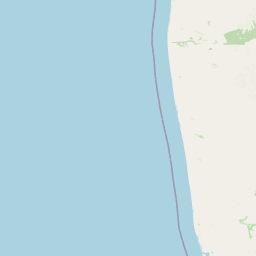
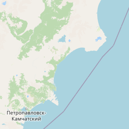

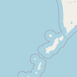


Map centered on the epicenter (52.01, 157.25). Map data © OpenStreetMap contributors.
Sky & Solar Conditions at the Time
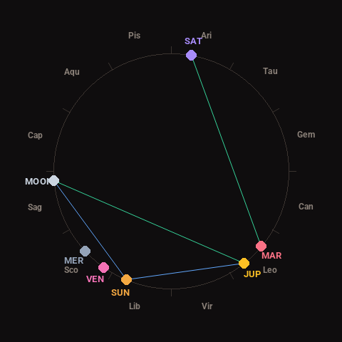
Moon: Waxing Crescent (27% illuminated), in Sagittarius.
Notable planetary angles: Mars trine Saturn (120°), Sun sextile Jupiter (61°), Sun sextile Moon (63°), Moon trine Jupiter (124°).
Concurrent space weather: planetary Kp index 3.3; strongest recent solar flare: nothing notable.
This is a factual snapshot, not a claim of cause and effect – researchers are divided on whether lunar, planetary or solar factors influence seismic or weather activity. It’s included so readers can track the pattern for themselves over time.
Earthquakes Within ~400 km, Past 30 Days
For context, here is other recent seismic activity in the surrounding region (M2.5+, via USGS):
| Date & Time (UTC) | Magnitude | Location |
|---|---|---|
| 2026-10-15 14:59 UTC | M4.9 | 198 km SSE of Vilyuchinsk, Russia |
| 2026-10-14 23:20 UTC | M4.5 | 82 km SSW of Mil’kovo, Russia |
| 2026-10-13 12:05 UTC | M4.9 | 180 km SE of Vilyuchinsk, Russia |
| 2026-10-11 17:00 UTC | M5.2 | 101 km SSW of Severo-Kuril’sk, Russia |
| 2026-10-11 11:18 UTC | M4.6 | 82 km E of Petropavlovsk-Kamchatsky, Russia |
| 2026-10-09 21:19 UTC | M4.6 | 96 km NE of Ozernovskiy, Russia |
| 2026-10-09 17:09 UTC | M4.8 | 191 km SE of Petropavlovsk-Kamchatsky, Russia |
| 2026-10-09 16:59 UTC | M4.7 | 138 km SE of Petropavlovsk-Kamchatsky, Russia |
| 2026-10-09 12:27 UTC | M4.4 | 58 km ENE of Petropavlovsk-Kamchatsky, Russia |
| 2026-10-07 00:30 UTC | M4.8 | 63 km ESE of Petropavlovsk-Kamchatsky, Russia |
| 2026-10-03 23:14 UTC | M4.3 | 90 km ESE of Ozernovskiy, Russia |
| 2026-10-03 20:00 UTC | M5.1 | 182 km SSE of Vilyuchinsk, Russia |
| 2026-10-03 19:30 UTC | M4.4 | 201 km SSE of Vilyuchinsk, Russia |
| 2026-10-03 10:02 UTC | M4.2 | 189 km SE of Petropavlovsk-Kamchatsky, Russia |
| 2026-10-03 02:59 UTC | M5.0 | 163 km SE of Petropavlovsk-Kamchatsky, Russia |
| 2026-10-03 01:53 UTC | M4.2 | 191 km SSE of Vilyuchinsk, Russia |
| 2026-10-03 01:01 UTC | M4.3 | 178 km E of Ozernovskiy, Russia |
| 2026-10-03 00:21 UTC | M4.4 | 15 km WSW of Yelizovo, Russia |
| 2026-10-03 00:01 UTC | M4.8 | 121 km SSE of Vilyuchinsk, Russia |
| 2026-10-02 23:59 UTC | M4.6 | 174 km SSE of Vilyuchinsk, Russia |
Emergency number for Russia: 112 (General guidance – always verify locally, as this can vary by region.)