The National Weather Service office in Tiyan, Guam has issued a Tropical Storm Warning for Saipan and Tinian in the Northern Mariana Islands, effective as of 4:11 PM ChST on October 16. A Tropical Storm Warning means tropical storm conditions – sustained winds of 39 to 73 mph, often with heavy rain and rough seas – are expected in the warned area, typically within 36 hours.
Residents of both islands should expect strengthening winds, periods of heavy rainfall, and deteriorating sea conditions. Power outages are possible as winds bring down tree limbs and power lines, and minor flooding can occur in low-lying or poorly drained areas. Ferry and small-craft activity between the islands is likely to be suspended, and flight disruptions at Saipan International Airport are possible as conditions worsen.
What to do now
Preparations should be completed promptly while conditions still allow:
Secure loose items. Bring indoors or tie down outdoor furniture, trash cans, and anything that could become a windborne hazard.
Stock essentials. Have drinking water, non-perishable food, flashlights, batteries, any needed medications, and a way to charge your phone in case power goes out.
Stay informed and off the water. Monitor local radio and official weather updates, avoid beaches and reefs due to dangerous surf, and follow any instructions from CNMI emergency management officials.
This is a routine but serious type of alert for the Marianas, and taking these basic steps now is the most effective way to ride out the storm safely.
Data for this alert comes from the National Weather Service (NWS) office in Tiyan, Guam, part of NOAA.
Frequently Asked Questions
Which islands are affected by this warning?
The Tropical Storm Warning currently covers two areas: Saipan and Tinian in the Commonwealth of the Northern Mariana Islands.
What should I do right now?
Secure loose outdoor items, stock water, food, batteries, and medications, and charge your devices. Avoid the ocean and finish preparations before winds strengthen.
How long will the storm conditions last?
A Tropical Storm Warning means conditions are expected within about 36 hours of issuance (4:11 PM ChST October 16); the warning stays in effect until the storm passes and NWS cancels or downgrades it.
Will flights and ferries be affected?
Likely yes – inter-island marine travel is typically suspended in tropical storm conditions, and flights at Saipan International Airport may be delayed or canceled, so check with your carrier before traveling.
Keep tracking this:
Source: National Weather Service (NWS)
Related Reading
- Emergency Communication: Staying Connected When Towers Go Down
- Earthquake Survival: Precautions, Kit & Early Warning in 2026
- Essential Guide to Preparing for a Nuclear War
Sky & Solar Conditions at the Time
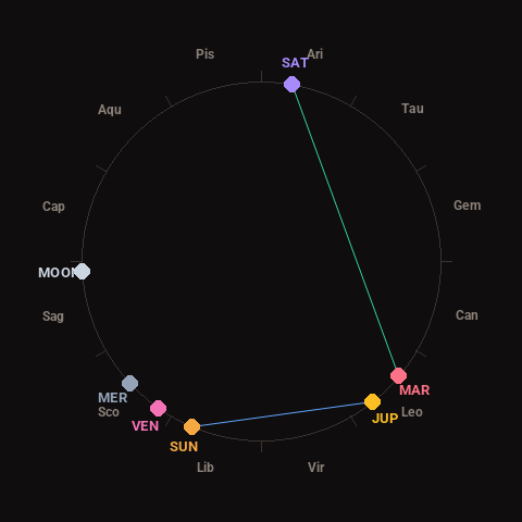
Moon: Waxing Crescent (28% illuminated), in Sagittarius.
Notable planetary angles: Mars trine Saturn (120°), Sun sextile Jupiter (61°).
Concurrent space weather: planetary Kp index 2.0; strongest recent solar flare: nothing notable.
This is a factual snapshot, not a claim of cause and effect – researchers are divided on whether lunar, planetary or solar factors influence seismic or weather activity. It’s included so readers can track the pattern for themselves over time.