A magnitude 6.0 earthquake struck offshore Vanuatu on a shallow fault, centered about 165 kilometers northwest of Port-Olry at a depth of roughly 10 kilometers, according to the USGS. Because it occurred offshore and at a shallow depth, shaking was likely felt across the northern Vanuatu islands, including Espiritu Santo, though the epicenter sits well away from the country’s largest population centers.
Port Vila, the capital with about 50,000 residents, lies roughly 477 kilometers from the epicenter, so shaking there would have been light to weak at most. Communities closest to the epicenter on the northern islands may have felt moderate to strong shaking, and buildings that are older or lightly built could sustain damage. At this time there are no confirmed reports of casualties or major structural damage.
What readers in the region might notice: rattling windows, swaying furniture, and possibly items falling from shelves near the epicenter. Because of the shallow depth, small localized changes to coastlines or brief unusual wave activity are possible, though no widespread destructive tsunami is expected from an earthquake of this size.
What to watch for
Aftershocks: This region is one of the most seismically active on Earth. At least 83 earthquakes of magnitude 5.0 or greater have been recorded within about 300 kilometers of this location in the past year. Aftershocks in the magnitude 4 to 5 range are likely over the coming days and could be felt again across the northern islands.
Local alerts: Residents in Vanuatu should monitor messages from the Vanuatu Meteorology and Geo-Hazards Department for any tsunami advisories or updated shaking reports, and should move away from coastlines if strong or prolonged shaking occurs.
Basic preparedness: Secure heavy furniture, keep a flashlight and sturdy shoes by the bed, and know your drop, cover, and hold-on procedure, especially with aftershocks expected.
Data for this alert comes from the United States Geological Survey (USGS) earthquake monitoring network.
Frequently Asked Questions
Was the earthquake felt in Port Vila?
Port Vila is about 477 kilometers from the epicenter, so any shaking there would have been weak. The strongest shaking was confined to Vanuatu's northern islands, closer to the epicenter northwest of Port-Olry.
Is a tsunami possible from this earthquake?
Shallow offshore earthquakes can generate local tsunamis, but a magnitude 6.0 is generally below the threshold for a large, destructive tsunami. Residents near the coast should still follow any guidance from Vanuatu's local hazard authorities.
Are aftershocks likely?
Yes. Aftershocks in the magnitude 4 to 5 range are common after a magnitude 6.0 event and can continue for days or weeks. This part of the Pacific is highly active, with more than 80 earthquakes of magnitude 5.0 or greater recorded nearby in the past year alone.
Could there be damage from this quake?
Damage is most likely limited to vulnerable or lightly built structures near the epicenter on the northern islands. No major damage or casualties have been confirmed at this time.
Keep tracking this:
Source: USGS
Related Reading
- Bug Out Bags: What the Best-Selling 72-Hour Kits on Amazon Actually Deliver
- Top 10 YouTube Videos on How to Prepare for an Earthquake
- Global Seismic Stress Report: Southern Ocean Activity Rises While Six Segments Go Quiet
Reported Impact
USGS’s automated PAGER system currently estimates a Green alert level (minimal expected casualties or damage).
Impact figures are from USGS as of when this alert was generated and can rise as more reports come in – this is not a final damage assessment.
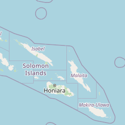

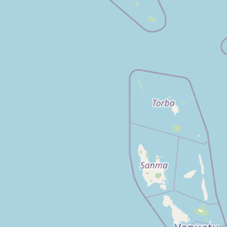

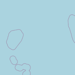
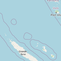
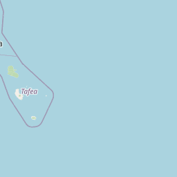
Map centered on the epicenter (-14.17, 165.82). Map data © OpenStreetMap contributors.
Sky & Solar Conditions at the Time
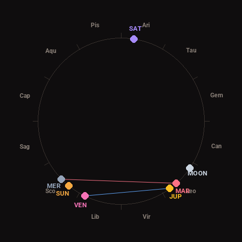
Moon: Last Quarter (54% illuminated), in Leo.
Notable planetary angles: Venus sextile Jupiter (62°), Mercury square Mars (87°).
Concurrent space weather: planetary Kp index 3.3; strongest recent solar flare: nothing notable.
This is a factual snapshot, not a claim of cause and effect – researchers are divided on whether lunar, planetary or solar factors influence seismic or weather activity. It’s included so readers can track the pattern for themselves over time.
Earthquakes Within ~400 km, Past 30 Days
For context, here is other recent seismic activity in the surrounding region (M2.5+, via USGS):
| Date & Time (UTC) | Magnitude | Location |
|---|---|---|
| 2026-10-31 23:57 UTC | M4.8 | 199 km NW of Port-Olry, Vanuatu |
| 2026-10-31 22:42 UTC | M5.2 | 200 km NW of Port-Olry, Vanuatu |
| 2026-10-31 11:31 UTC | M5.0 | 196 km NW of Port-Olry, Vanuatu |
| 2026-10-31 09:18 UTC | M4.9 | 236 km NW of Port-Olry, Vanuatu |
| 2026-10-31 09:15 UTC | M4.9 | 213 km W of Sola, Vanuatu |
| 2026-10-31 00:26 UTC | M4.8 | 97 km ENE of Port-Olry, Vanuatu |
| 2026-10-30 22:14 UTC | M4.7 | 222 km NW of Port-Olry, Vanuatu |
| 2026-10-30 12:40 UTC | M4.7 | 148 km NW of Port-Olry, Vanuatu |
| 2026-10-29 21:46 UTC | M6.2 | 43 km ESE of Port-Olry, Vanuatu |
| 2026-10-29 00:57 UTC | M4.9 | 117 km E of Port-Olry, Vanuatu |
| 2026-10-29 00:08 UTC | M5.4 | 109 km ENE of Luganville, Vanuatu |
| 2026-10-28 04:31 UTC | M5.0 | 200 km W of Sola, Vanuatu |
| 2026-10-28 02:59 UTC | M5.6 | 174 km NW of Port-Olry, Vanuatu |
| 2026-10-28 02:21 UTC | M6.0 | 214 km NW of Port-Olry, Vanuatu |
| 2026-10-28 02:17 UTC | M5.2 | 220 km NW of Port-Olry, Vanuatu |
| 2026-10-28 02:13 UTC | M4.8 | 217 km NW of Port-Olry, Vanuatu |
| 2026-10-28 01:39 UTC | M5.5 | 221 km NW of Port-Olry, Vanuatu |
| 2026-10-27 10:50 UTC | M5.2 | 191 km NW of Port-Olry, Vanuatu |
| 2026-10-27 10:06 UTC | M5.0 | 184 km NW of Port-Olry, Vanuatu |
| 2026-10-27 09:20 UTC | M5.0 | 206 km NW of Port-Olry, Vanuatu |
Emergency number for Vanuatu: 112 (General guidance – always verify locally, as this can vary by region.)