
A magnitude 6.6 earthquake struck the Banda Sea region of eastern Indonesia, centered about 151 kilometers west-southwest of Tual, in the Maluku Islands, according to the US Geological Survey. The quake occurred at a depth of roughly 35 kilometers, which is considered a shallow-to-intermediate depth. Quakes at this depth tend to be felt over a wide area, but the offshore location limits the risk to people on land.
Because the epicenter sits well out to sea, the strongest shaking occurred beneath the ocean floor. Residents of Tual and the surrounding Kei Islands may have felt moderate to strong shaking lasting several seconds, and lighter shaking may have been noticed across parts of the southern Maluku province and possibly into western Papua. The nearest major city, Port Moresby in Papua New Guinea, is roughly 1,774 kilometers away and would not have felt this event.
Damage risk is concentrated on the small islands closest to the epicenter, where older masonry and unreinforced buildings are most vulnerable to cracking or partial collapse. As of the initial report, there were no confirmed reports of casualties or major structural damage, but information from remote islands in this region often takes hours to arrive.
What to watch for
Aftershocks: Earthquakes of this size are almost always followed by smaller aftershocks, some of which can be felt. This area is seismically very active — at least 22 earthquakes of magnitude 5.0 or greater have been recorded within about 300 kilometers of this location in the past year — so additional shaking would not be unusual.
Tsunami status: At magnitude 6.6 and 35 kilometers deep, this quake is not the type that typically generates a destructive tsunami. No widespread tsunami threat has been issued. People on nearby coastlines should still follow any instructions from Indonesian authorities (BMKG) as a routine precaution.
Local infrastructure: If you have family or contacts in the Maluku Islands, expect possible power interruptions or slow communications while local assessments are carried out.
This alert is based on earthquake data reported by the US Geological Survey (USGS).
Frequently Asked Questions
Was this earthquake felt in any major cities?
No major cities are near the epicenter. The strongest shaking was felt in Tual and the Kei Islands; the nearest large city, Port Moresby, is about 1,774 km away and would not have felt it.
Is a tsunami possible from this quake?
A destructive tsunami is unlikely — at magnitude 6.6 and 35 km depth, this event is below the typical threshold for significant tsunami generation, and no widespread tsunami warning has been issued. Coastal residents should still follow guidance from Indonesia's BMKG.
Are aftershocks likely?
Yes. Earthquakes of this size are routinely followed by aftershocks over the coming days and weeks, and this part of the Banda Sea is already one of the most seismically active areas in the region.
Should people in Indonesia outside the Maluku Islands be concerned?
No. The quake was offshore and distant from major population centers, so areas beyond the southern Maluku province are not expected to experience any effects from this event.
Keep tracking this:
Source: USGS
Related Reading
- Bug Out Bags: What the Best-Selling 72-Hour Kits on Amazon Actually Deliver
- Top 10 YouTube Videos on How to Prepare for an Earthquake
- Global Seismic Stress Report: Southern Ocean Activity Rises While Six Segments Go Quiet
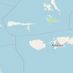
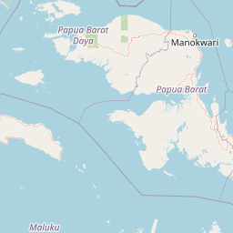
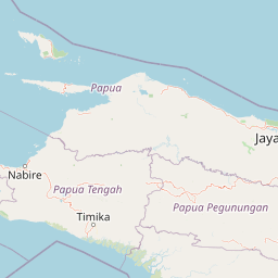
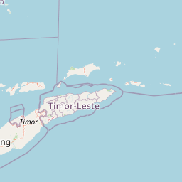
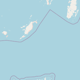
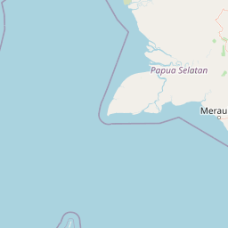
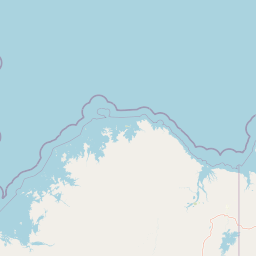

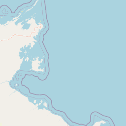
Map centered on the epicenter (-6.03, 131.45). Map data © OpenStreetMap contributors.
Sky & Solar Conditions at the Time
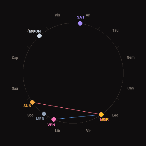
Moon: First Quarter (44% illuminated), in Aquarius.
Notable planetary angles: Mars conjunct Jupiter (0°), Sun square Jupiter (89°), Sun square Mars (88°), Venus sextile Jupiter (57°).
Concurrent space weather: planetary Kp index 0.7; strongest recent solar flare: nothing notable.
This is a factual snapshot, not a claim of cause and effect – researchers are divided on whether lunar, planetary or solar factors influence seismic or weather activity. It’s included so readers can track the pattern for themselves over time.
Earthquakes Within ~400 km, Past 30 Days
For context, here is other recent seismic activity in the surrounding region (M2.5+, via USGS):
| Date & Time (UTC) | Magnitude | Location |
|---|---|---|
| 2026-11-15 20:51 UTC | M5.0 | 256 km SSE of Ambon, Indonesia |
| 2026-11-15 16:06 UTC | M4.2 | 273 km W of Tual, Indonesia |
| 2026-11-13 07:55 UTC | M4.4 | 152 km WSW of Fakfak, Indonesia |
| 2026-11-11 12:17 UTC | M4.7 | 168 km W of Fakfak, Indonesia |
| 2026-11-11 12:10 UTC | M4.6 | 130 km E of Masohi, Indonesia |
| 2026-11-11 11:32 UTC | M5.1 | Pulau Pulau Tanimbar, Indonesia |
| 2026-11-10 01:53 UTC | M5.4 | Pulau Pulau Tanimbar, Indonesia |
| 2026-11-09 16:52 UTC | M4.5 | 152 km E of Masohi, Indonesia |
| 2026-11-09 14:55 UTC | M4.3 | 164 km E of Masohi, Indonesia |
| 2026-11-09 09:53 UTC | M4.8 | 183 km E of Masohi, Indonesia |
| 2026-11-09 09:48 UTC | M5.4 | 160 km E of Masohi, Indonesia |
| 2026-11-02 11:18 UTC | M4.4 | Banda Sea |
| 2026-11-02 00:53 UTC | M5.1 | Banda Sea |
| 2026-10-31 13:10 UTC | M4.3 | Banda Sea |
| 2026-10-30 16:54 UTC | M4.2 | 269 km NNE of Lospalos, Timor Leste |
| 2026-10-29 20:32 UTC | M5.0 | 130 km N of Tual, Indonesia |
| 2026-10-29 11:38 UTC | M4.6 | Pulau Pulau Tanimbar, Indonesia |
| 2026-10-28 22:06 UTC | M5.7 | 271 km WSW of Tual, Indonesia |
| 2026-10-28 03:44 UTC | M4.3 | Banda Sea |
| 2026-10-25 19:26 UTC | M4.4 | 250 km WSW of Tual, Indonesia |
Emergency number for Indonesia: 112 (General guidance – always verify locally, as this can vary by region.)