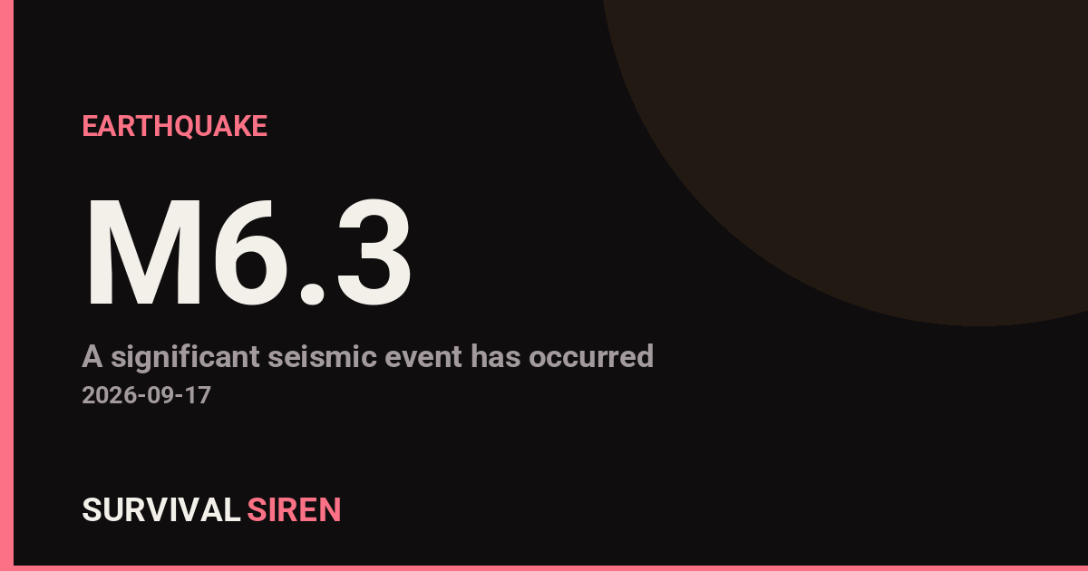
A magnitude 6.3 earthquake struck the Aleutian Islands region of Alaska today, centered about 167 kilometers (roughly 104 miles) west of the small community of Nikolski. The quake occurred at a depth of about 83 kilometers (around 51 miles) below the surface, according to the U.S. Geological Survey.
That depth matters. Deep earthquakes like this one spread their energy over a wider area but tend to produce less intense shaking at the surface than a shallow quake of the same size. Because the epicenter is offshore in a very remote part of the Aleutian chain, the number of people near it is small. Nikolski, the nearest community, has a population of only a few dozen residents. Shaking may have been felt lightly across parts of the central and western Aleutians, but widespread damage is not expected given the depth and distance from populated areas.
This part of Alaska is one of the most seismically active regions in the world, sitting along the boundary where the Pacific Plate slides beneath the North American Plate. Earthquakes of this magnitude are not unusual here, and they rarely cause serious problems far from the epicenter.
What to watch for
Aftershocks: Quakes of this size are typically followed by smaller aftershocks over the coming hours and days. Most will be too deep or too weak to be felt on land.
Tsunami status: Intermediate-depth quakes like this one rarely generate tsunamis, and no tsunami threat is anticipated for this event. If you live along the coast and ever feel strong, long-lasting shaking, move to higher ground without waiting for an alert.
General readiness: If you live in the Aleutians or anywhere in coastal Alaska, this is a good reminder to keep a go-bag, secure heavy furniture, and know your local evacuation route.
Data for this alert comes from the U.S. Geological Survey (USGS) earthquake monitoring network.
Frequently Asked Questions
Was this earthquake felt in nearby cities?
The epicenter is in a remote part of the Aleutian Islands, about 104 miles west of Nikolski, so only light shaking was possible in small nearby communities. Larger population centers like Anchorage, nearly 900 miles away, would not have felt it.
Is a tsunami possible from this quake?
No tsunami threat is expected. At 83 km deep, this earthquake's energy was released well below the seafloor, and quakes of this depth rarely displace enough water to generate a tsunami.
Are aftershocks likely?
Yes, earthquakes of this magnitude are usually followed by aftershocks over the coming days. Given the depth and remote location, most will be too weak to notice on land.
Could this quake cause damage?
Significant damage is unlikely because the epicenter is far from populated areas and the quake was fairly deep, which softens surface shaking. USGS may still collect felt reports from nearby Aleutian communities.
Keep tracking this:
Source: USGS
Related Reading
- Global Seismic Stress Report: Southern Ocean Activity Rises While Six Segments Go Quiet
- Earthquake Survival: Precautions, Kit & Early Warning in 2026
- Analyzing Low-Radiation Nuclear Explosions: Tactical Assessments and Survival Strategies
Reported Impact
USGS flagged this event as having tsunami potential – check official tsunami warning centers for your region.
Impact figures are from USGS as of when this alert was generated and can rise as more reports come in – this is not a final damage assessment.





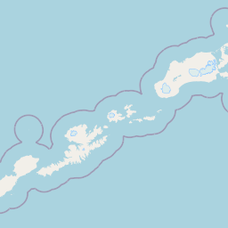



Map centered on the epicenter (52.81, -171.34). Map data © OpenStreetMap contributors.
Sky & Solar Conditions at the Time
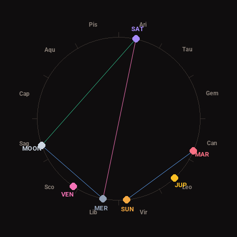
Moon: First Quarter (38% illuminated), in Sagittarius.
Notable planetary angles: Moon sextile Mercury (60°), Sun sextile Mars (61°), Mercury opposite Saturn (179°), Moon trine Saturn (121°).
Concurrent space weather: planetary Kp index 1.7; strongest recent solar flare: nothing notable.
This is a factual snapshot, not a claim of cause and effect – researchers are divided on whether lunar, planetary or solar factors influence seismic or weather activity. It’s included so readers can track the pattern for themselves over time.
Earthquakes Within ~400 km, Past 30 Days
For context, here is other recent seismic activity in the surrounding region (M2.5+, via USGS):
| Date & Time (UTC) | Magnitude | Location |
|---|---|---|
| 2026-09-16 12:47 UTC | M3.6 | 95 km SSW of Unalaska, Alaska |
| 2026-09-16 08:28 UTC | M3.9 | 167 km WSW of Nikolski, Alaska |
| 2026-09-15 13:14 UTC | M2.5 | 92 km E of Nikolski, Alaska |
| 2026-09-15 08:42 UTC | M2.9 | 97 km SSW of Nikolski, Alaska |
| 2026-09-15 07:08 UTC | M2.5 | 85 km WSW of Atka, Alaska |
| 2026-09-15 05:21 UTC | M4.0 | 92 km SSW of Unalaska, Alaska |
| 2026-09-15 00:35 UTC | M2.5 | 55 km SE of Adak, Alaska |
| 2026-09-14 22:51 UTC | M2.7 | 111 km SSW of Nikolski, Alaska |
| 2026-09-14 04:38 UTC | M2.6 | 79 km SSE of Adak, Alaska |
| 2026-09-13 21:57 UTC | M2.9 | 210 km S of Atka, Alaska |
| 2026-09-13 10:15 UTC | M3.2 | 78 km E of Nikolski, Alaska |
| 2026-09-13 01:46 UTC | M2.7 | 126 km SSW of Nikolski, Alaska |
| 2026-09-12 23:33 UTC | M2.5 | 71 km SSW of Atka, Alaska |
| 2026-09-12 23:15 UTC | M2.5 | 95 km SSW of Nikolski, Alaska |
| 2026-09-12 18:16 UTC | M3.4 | 94 km SSW of Nikolski, Alaska |
| 2026-09-12 17:25 UTC | M2.6 | 68 km E of Atka, Alaska |
| 2026-09-12 15:21 UTC | M3.4 | 74 km SE of Atka, Alaska |
| 2026-09-12 10:14 UTC | M3.6 | 86 km SSW of Unalaska, Alaska |
| 2026-09-12 07:50 UTC | M2.7 | 105 km SSE of Adak, Alaska |
| 2026-09-12 07:50 UTC | M2.6 | 102 km SSE of Adak, Alaska |
Emergency number for Alaska: 911 (General guidance – always verify locally, as this can vary by region.)