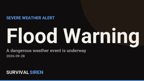
Flood Warning in Effect for Washington, RI Until 2:00 PM EDT Today
Flood Warning issued September 14 at 5:18AM EDT until September 14 at 2:00PM EDT by NWS Boston/Norton MA (National Weather Service, United States). Affected area: Washington, RI.
Flash Flood Warning issued September 13 at 8:12PM MST until September 13 at 9:45PM MST by NWS Tucson AZ (National Weather Service, United States). Currently covers 3 areas: Cochise, AZ; Rio Blanco, CO; Coconino, AZ.
Flood Warning issued September 13 at 5:37AM EDT until September 13 at 8:00AM EDT by NWS Charleston WV (National Weather Service, United States). Currently covers 20 areas: Athens, OH; Meigs, OH; Washington, OH; Pleasants, WV; Wood, WV; Gallia, OH; Mason, WV; Doddridge, WV; Gilmer, WV; Lewis, WV (+10 more areas).
Flash Flood Warning issued September 13 at 4:43AM EDT until September 13 at 7:45AM EDT by NWS Wakefield VA (National Weather Service, United States). Affected area: Worcester, MD.
Flood Warning issued September 12 at 12:32PM EDT by NWS Peachtree City GA (National Weather Service, United States). Affected area: Cobb, GA.
Flash Flood Warning issued September 12 at 10:23AM EDT until September 12 at 1:30PM EDT by NWS Peachtree City GA (National Weather Service, United States). Currently covers 6 areas: Cobb, GA; DeKalb, GA; Fulton, GA; Douglas, GA; Carroll, GA; Paulding, GA.
Flood Warning issued September 11 at 9:20AM EDT by NWS Tampa Bay Ruskin FL (National Weather Service, United States). Affected area: DeSoto, FL.
Flash Flood Warning issued September 11 at 4:56PM EDT until September 11 at 10:30PM EDT by NWS Peachtree City GA (National Weather Service, United States). Currently covers 14 areas: Clayton, GA; DeKalb, GA; Fulton, GA; Navajo, AZ; Carroll, GA; Douglas, GA; Haralson, GA; Paulding, GA; Charleston, SC; Colleton, SC (+4 more areas).
Hurricane Warning issued September 7 at 4:57PM HST by NWS Honolulu HI (National Weather Service, United States). Currently covers 8 areas: Kauai Northwest Waters; Kauai Leeward Waters; Niihau; Kauai Southwest; Kauai South; Kauai East; Kauai Mountains; Kauai North.
Tropical Storm Warning issued September 7 at 4:57PM HST by NWS Honolulu HI (National Weather Service, United States). Currently covers 14 areas: Kauai Windward Waters; Kauai Channel; Oahu Windward Waters; Oahu Leeward Waters; Olomana; Waianae Coast; Ewa Plain; Koolau Leeward; Waianae Mountains; Koolau Windward (+4 more areas).
Tropical Storm Warning issued September 6 at 11:09PM HST by NWS Honolulu HI (National Weather Service, United States). Currently covers 2 areas: Kauai Channel; Kauai Windward Waters.
Hurricane Warning issued September 6 at 11:09PM HST by NWS Honolulu HI (National Weather Service, United States). Currently covers 8 areas: Kauai Northwest Waters; Kauai Leeward Waters; Kauai North; Kauai Mountains; Niihau; Kauai Southwest; Kauai South; Kauai East.
Tropical Storm Warning issued September 6 at 4:57AM HST by NWS Honolulu HI (National Weather Service, United States). Currently covers 10 areas: Kauai Northwest Waters; Kauai Windward Waters; Kauai Leeward Waters; Kauai Channel; Kauai Southwest; Kauai East; Kauai South; Niihau; Kauai Mountains; Kauai North.
Flash Flood Warning issued September 2 at 5:46AM CDT until September 2 at 10:45AM CDT by NWS Lake Charles LA (National Weather Service, United States). Currently covers 2 areas: Hardin, TX; Tyler, TX.
Tropical Storm Warning issued September 1 at 4:02PM CDT by NWS Lake Charles LA (National Weather Service, United States). Affected area: East Cameron.
Tropical Storm Warning issued September 1 at 4:20AM CDT by NWS Lake Charles LA (National Weather Service, United States). Currently covers 23 areas: Sabine Lake; Calcasieu Lake; Coastal waters from Cameron LA to High Island TX out 20 NM; Coastal waters from Intracoastal City to Cameron LA out 20 NM; Coastal waters from Lower Atchafalaya River to Intracoastal City LA out 20 NM; Waters from Cameron LA to High Island TX from 20 to 60 NM; Waters from Intracoastal City to Cameron LA from 20 to 60 NM; Waters from Lower Atchafalaya River to Intracoastal City LA from 20 to 60 NM; Coastal waters from High Island to Freeport TX out 20 NM; Waters from High Island to Freeport TX from 20 to 60 NM (+13 more areas).
Tropical Storm Warning issued August 31 at 10:10AM CDT by NWS Houston/Galveston TX (National Weather Service, United States). Currently covers 5 areas: Chambers; Bolivar Peninsula; East Cameron; West Cameron; Lower Jefferson.
Nepal glacier collapse. What happened, how did it happened and what is going to happen? All the news and more.
Tropical Storm Warning issued August 16 at 11:30AM HST by NWS Honolulu HI (National Weather Service, United States). Currently covers 47 areas: Molokai Southeast; Lanai Windward; Lanai Mauka; Maui Windward West; Oahu North Shore; Molokai West; Kauai North; Kauai Southwest; Molokai Leeward South; Kauai Mountains (+37 more areas).
Hurricane Warning issued August 15 at 11:00PM HST by NWS Honolulu HI (National Weather Service, United States). Currently covers 12 areas: Big Island Summit; Kona; Big Island Southeast; Big Island East; Big Island South; Big Island Interior; Big Island North; Kohala; Alenuihaha Channel; Big Island Windward Waters (+2 more areas).
Flash Flood Warning issued August 15 at 9:53PM HST until August 16 at 1:00AM HST by NWS Honolulu HI (National Weather Service, United States). Affected area: Hawaii in Hawaii, HI.
Tropical Storm Warning issued August 15 at 5:28PM HST by NWS Honolulu HI (National Weather Service, United States). Currently covers 46 areas: Maui Windward West; Windward Haleakala; Molokai Windward; Ewa Plain; Waianae Coast; Kauai Southwest; Olomana; Central Oahu; Maui Central Valley North; Maui Central Valley South (+36 more areas).
Hurricane Warning issued August 15 at 4:58AM HST by NWS Honolulu HI (National Weather Service, United States). Currently covers 12 areas: Big Island Summit; Big Island Southeast; Big Island North; Big Island South; Kona; Big Island East; Big Island Interior; Kohala; Alenuihaha Channel; Big Island Windward Waters (+2 more areas).
Tropical Storm Warning issued August 14 at 10:40PM HST by NWS Honolulu HI (National Weather Service, United States). Currently covers 46 areas: Oahu North Shore; Molokai Leeward South; East Honolulu; Kipahulu; Koolau Windward; South Haleakala; Molokai North; Molokai Southeast; Koolau Leeward; Central Oahu (+36 more areas).
Hurricane Warning issued August 14 at 10:38AM HST by NWS Honolulu HI (National Weather Service, United States). Currently covers 12 areas: Big Island Southeast; Kohala; Big Island East; Big Island South; Big Island North; Big Island Interior; Kona; Big Island Summit; Alenuihaha Channel; Big Island Windward Waters (+2 more areas).
Tropical Storm Warning issued August 14 at 4:47AM HST by NWS Honolulu HI (National Weather Service, United States). Currently covers 19 areas: Molokai Leeward South; Molokai Southeast; Lanai Leeward; Molokai Windward; Maui Central Valley South; Molokai West; South Maui/Upcountry; Windward Haleakala; Kipahulu; Maui Central Valley North (+9 more areas).
Hurricane Warning issued August 13 at 4:49PM HST by NWS Honolulu HI (National Weather Service, United States). Currently covers 8 areas: Big Island Summit; Big Island Interior; Kohala; Big Island East; Big Island North; Kona; Big Island South; Big Island Southeast.
Flash Flood Warning issued August 13 at 9:39PM EDT until August 13 at 11:30PM EDT by NWS Jackson KY (National Weather Service, United States). Affected area: Knott, KY.
Flash Flood Warning issued August 12 at 10:17AM EDT until August 12 at 4:15PM EDT by NWS Indianapolis IN (National Weather Service, United States). Affected area: Delaware, IN.
Flash Flood Warning issued August 11 at 1:02AM EDT until August 11 at 3:00AM EDT by NWS Charleston WV (National Weather Service, United States). Affected area: Perry, OH.
Flash Flood Warning issued August 2 at 12:32AM EDT until August 2 at 8:30AM EDT by NWS Blacksburg VA (National Weather Service, United States). Affected area: Surry, NC.
Flash Flood Warning issued July 29 at 5:47PM MDT until July 29 at 9:00PM MDT by NWS Grand Junction CO (National Weather Service, United States). Affected area: Ouray, CO.
Flash Flood Warning issued July 28 at 5:04PM MDT until July 28 at 8:00PM MDT by NWS Pueblo CO (National Weather Service, United States). Currently covers 2 areas: Custer, CO; Pueblo, CO.
Tropical Storm Warning issued July 23 at 10:39AM CDT by NWS Houston/Galveston TX (National Weather Service, United States). Currently covers 26 areas: Galveston Bay; Coastal waters from High Island to Freeport TX out 20 NM; Waters from Freeport to Matagorda Ship Channel TX from 20 to 60 NM; Waters from High Island to Freeport TX from 20 to 60 NM; Coastal Brazoria; Chambers; Galveston Island; Brazoria Islands; Coastal Galveston; Bolivar Peninsula (+16 more areas).
Tropical Storm Warning issued July 22 at 6:45PM CDT by NWS Mobile AL (National Weather Service, United States). Currently covers 57 areas: Mobile Coastal; Mobile Central; Baldwin Coastal; Baldwin Central; Lake Pontchartrain; Mississippi Sound; Lake Salvador and Lake Cataouatche; Lake Borgne; Breton Sound; Chandeleur Sound (+47 more areas).
Tropical Storm Warning issued July 21 at 11:20PM EDT by NWS Tallahassee FL (National Weather Service, United States). Currently covers 59 areas: St. Andrews Bay Waterways; Coastal waters from Okaloosa-Walton County Line to Mexico Beach out 20 NM; Coastal Waters from Mexico Beach to Apalachicola out 20 NM; Waters from Okaloosa-Walton County Line to Mexico Beach from 20 to 60 NM; Waters from Mexico Beach to Apalachicola FL from 20 to 60 NM; North Mobile Bay; South Mobile Bay; Mississippi Sound; Perdido Bay Area; Pensacola Bay Area including Santa Rosa Sound (+49 more areas).
Flash Flood Warning issued July 21 at 7:26PM EDT until July 21 at 10:30PM EDT by NWS Charleston WV (National Weather Service, United States). Currently covers 3 areas: Lewis, WV; Randolph, WV; Upshur, WV.
Tropical Storm Warning issued July 21 at 4:44AM CDT by NWS New Orleans LA (National Weather Service, United States). Currently covers 27 areas: Mississippi Sound; Lake Borgne; Breton Sound; Chandeleur Sound; Coastal Waters from Boothville LA to Southwest Pass of the Mississippi River out 20 nm; Coastal waters from Pascagoula Mississippi to Stake Island out 20 NM; Coastal Waters from Stake Island LA to Southwest Pass of the Mississippi River from 20 to 60 nm; Coastal waters from Pascagoula Mississippi to Stake Island Louisiana out 20 to 60 NM; North Mobile Bay; South Mobile Bay (+17 more areas).
Tropical Storm Warning issued July 20 at 10:55AM EDT by NWS Tallahassee FL (National Weather Service, United States). Affected area: Waters from Okaloosa-Walton County Line to Mexico Beach from 20 to 60 NM; Waters from Mexico Beach to Apalachicola FL from 20 to 60 NM; Waters from Suwannee River to Apalachicola FL from 20 to 60 NM.
Tropical Storm Warning issued July 20 at 4:51AM EDT by NWS Tallahassee FL (National Weather Service, United States). Affected area: Waters from Okaloosa-Walton County Line to Mexico Beach from 20 to 60 NM; Waters from Mexico Beach to Apalachicola FL from 20 to 60 NM; Waters from Suwannee River to Apalachicola FL from 20 to 60 NM.
Tropical Storm Warning issued July 19 at 11:00PM EDT by NWS Tallahassee FL (National Weather Service, United States). Affected area: Waters from Okaloosa-Walton County Line to Mexico Beach from 20 to 60 NM; Waters from Mexico Beach to Apalachicola FL from 20 to 60 NM; Waters from Suwannee River to Apalachicola FL from 20 to 60 NM.
Flash Flood Warning issued July 19 at 6:20PM MDT until July 19 at 8:00PM MDT by NWS Salt Lake City UT (National Weather Service, United States). Affected area: Beaver, UT.
Flash Flood Warning issued July 19 at 3:16PM MDT until July 19 at 8:00PM MDT by NWS Salt Lake City UT (National Weather Service, United States). Affected area: Beaver, UT.
Tropical Storm Warning issued July 19 at 5:01PM EDT by NWS Tallahassee FL (National Weather Service, United States). Affected area: Waters from Okaloosa-Walton County Line to Mexico Beach from 20 to 60 NM; Waters from Mexico Beach to Apalachicola FL from 20 to 60 NM; Waters from Suwannee River to Apalachicola FL from 20 to 60 NM.
Flash Flood Warning issued July 19 at 3:03PM MDT until July 19 at 8:00PM MDT by NWS Salt Lake City UT (National Weather Service, United States). Affected area: Beaver, UT.
Flash Flood Warning issued July 19 at 2:52PM MDT until July 19 at 8:00PM MDT by NWS Salt Lake City UT (National Weather Service, United States). Affected area: Beaver, UT.
Tropical Storm Warning issued July 19 at 11:03AM EDT by NWS Tallahassee FL (National Weather Service, United States). Affected area: Waters from Okaloosa-Walton County Line to Mexico Beach from 20 to 60 NM; Waters from Mexico Beach to Apalachicola FL from 20 to 60 NM; Waters from Suwannee River to Apalachicola FL from 20 to 60 NM.
Flash Flood Warning issued July 17 at 2:10PM CDT until July 17 at 5:15PM CDT by NWS San Angelo TX (National Weather Service, United States). Affected area: Crockett, TX.
Flash Flood Warning issued July 17 at 1:37PM CDT until July 17 at 2:15PM CDT by NWS San Angelo TX (National Weather Service, United States). Affected area: Crockett, TX.
Flash Flood Warning issued July 17 at 11:14AM CDT until July 17 at 2:15PM CDT by NWS San Angelo TX (National Weather Service, United States). Affected area: Crockett, TX.