M5.1 Earthquake Strikes South Sandwich Islands Region
A magnitude 5.1 earthquake struck South Sandwich Islands region at a depth of about 10 km, reported by the USGS. Shaking would likely be felt in the surrounding region.
A magnitude 5.5 earthquake struck Fiji region at a depth of about 574 km, reported by the USGS. Shaking would likely be felt in the surrounding region.
A magnitude 5.4 earthquake struck 90 km SSE of False Pass, Alaska at a depth of about 47 km, reported by the USGS. Shaking would likely be felt in the surrounding region.
A magnitude 5.3 earthquake struck 101 km SE of False Pass, Alaska at a depth of about 5 km, reported by the USGS. Shaking would likely be felt in the surrounding region.
A magnitude 6.2 earthquake struck 34 km WSW of Sarangani, Philippines at a depth of about 68 km, reported by the USGS. Earthquakes of this size can cause significant damage to vulnerable structures near the epicenter.
A magnitude 5.1 earthquake struck 3 km NNW of Sugal, Philippines at a depth of about 24 km, reported by the USGS. Shaking would likely be felt in the surrounding region.
A magnitude 5.3 earthquake struck 96 km SE of False Pass, Alaska at a depth of about 41 km, reported by the USGS. Shaking would likely be felt in the surrounding region.
A magnitude 5.4 earthquake struck 105 km SE of False Pass, Alaska at a depth of about 1 km, reported by the USGS. Shaking would likely be felt in the surrounding region.
A large-scale power outage is being reported: "Cuba faces nationwide blackout as energy grid collapses". Widespread outages can be caused by severe weather, grid failures, or - relevant to what this site tracks - a strong geomagnetic storm inducing damaging currents in transformers.

A magnitude 5.6 earthquake struck 11 km N of Pichigua, Peru at a depth of about 140 km, reported by the USGS. Shaking would likely be felt in the surrounding region.
A magnitude 5.0 earthquake struck 117 km E of Noda, Japan at a depth of about 11 km, reported by the USGS. Shaking would likely be felt in the surrounding region.
A magnitude 5.2 earthquake struck 14 km WSW of Mabiton, Philippines at a depth of about 10 km, reported by the USGS. Shaking would likely be felt in the surrounding region.
A magnitude 5.0 earthquake struck 2 km WSW of Congregación Reforma, Mexico at a depth of about 80 km, reported by the USGS. Shaking would likely be felt in the surrounding region.
A magnitude 5.0 earthquake struck southeast of the Loyalty Islands at a depth of about 10 km, reported by the USGS. Shaking would likely be felt in the surrounding region.
A magnitude 5.0 earthquake struck 5 km SE of Butulan, Philippines at a depth of about 20 km, reported by the USGS. Shaking would likely be felt in the surrounding region.
A magnitude 5.1 earthquake struck southeast of the Loyalty Islands at a depth of about 10 km, reported by the USGS. Shaking would likely be felt in the surrounding region.
A magnitude 6.3 earthquake struck southeast of the Loyalty Islands at a depth of about 10 km, reported by the USGS. Earthquakes of this size can cause significant damage to vulnerable structures near the epicenter.
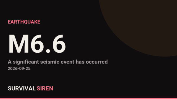
A magnitude 6.7 earthquake struck southeast of the Loyalty Islands at a depth of about 10 km, reported by the USGS. Earthquakes of this size can cause significant damage to vulnerable structures near the epicenter.
A large-scale power outage is being reported: "International News: Cuba suffers 2nd nationwide blackout in a week as power crisis deepens". Widespread outages can be caused by severe weather, grid failures, or - relevant to what this site tracks - a strong geomagnetic storm inducing damaging currents in transformers.
A magnitude 6.4 earthquake struck 191 km SE of Lorengau, Papua New Guinea at a depth of about 10 km, reported by the USGS. Earthquakes of this size can cause significant damage to vulnerable structures near the epicenter.
A magnitude 5.0 earthquake struck southeast of the Loyalty Islands at a depth of about 10 km, reported by the USGS. Shaking would likely be felt in the surrounding region.
A magnitude 5.4 earthquake struck 24 km WSW of Mabiton, Philippines at a depth of about 10 km, reported by the USGS. Shaking would likely be felt in the surrounding region.
A magnitude 5.3 earthquake struck 192 km WNW of Gorontalo, Indonesia at a depth of about 35 km, reported by the USGS. Shaking would likely be felt in the surrounding region.
A magnitude 5.1 earthquake struck 27 km SSE of Tambolaka, Indonesia at a depth of about 43 km, reported by the USGS. Shaking would likely be felt in the surrounding region.
A magnitude 5.0 earthquake struck 139 km S of ‘Ohonua, Tonga at a depth of about 10 km, reported by the USGS. Shaking would likely be felt in the surrounding region.
GOES satellites measured a M1.2-class solar flare peaking at 2026-07-12T08:11:00Z (X-ray flux 1.2e-5 W/m2, radio-blackout scale ~R1). Flares cause immediate shortwave radio blackouts on Earth's sunlit side. If this flare launched a CME toward Earth, a geomagnetic storm could follow in 1-3 days - worth watching the Kp index.
A magnitude 5.5 earthquake struck southern East Pacific Rise at a depth of about 10 km, reported by the USGS. Shaking would likely be felt in the surrounding region.
A large-scale power outage is being reported: "Cuba's power grid collapses, plunges eastern provinces into major blackout". Widespread outages can be caused by severe weather, grid failures, or - relevant to what this site tracks - a strong geomagnetic storm inducing damaging currents in transformers.

A magnitude 5.2 earthquake struck 56 km SSW of Sarangani, Philippines at a depth of about 62 km, reported by the USGS. Shaking would likely be felt in the surrounding region.
A magnitude 5.1 earthquake struck 89 km NE of Hihifo, Tonga at a depth of about 10 km, reported by the USGS. Shaking would likely be felt in the surrounding region.
A magnitude 5.4 earthquake struck 41 km S of Sarangani, Philippines at a depth of about 57 km, reported by the USGS. Shaking would likely be felt in the surrounding region.
A magnitude 6.4 earthquake struck South Sandwich Islands region at a depth of about 46 km, reported by the USGS. Earthquakes of this size can cause significant damage to vulnerable structures near the epicenter.
A large-scale power outage is being reported: "Cuba suffers second nationwide blackout in five days". Widespread outages can be caused by severe weather, grid failures, or - relevant to what this site tracks - a strong geomagnetic storm inducing damaging currents in transformers.

A magnitude 5.1 earthquake struck 129 km SW of Huarmey, Peru at a depth of about 10 km, reported by the USGS. Shaking would likely be felt in the surrounding region.
A magnitude 5.4 earthquake struck South Sandwich Islands region at a depth of about 105 km, reported by the USGS. Shaking would likely be felt in the surrounding region.
A magnitude 5.0 earthquake struck 299 km W of Neiafu, Tonga at a depth of about 368 km, reported by the USGS. Shaking would likely be felt in the surrounding region.
Flash Flood Warning issued July 10 at 1:46PM CDT until July 10 at 4:15PM CDT by NWS St Louis MO (National Weather Service, United States). Affected area: Iron, MO; Reynolds, MO.
A magnitude 5.0 earthquake struck west of Macquarie Island at a depth of about 10 km, reported by the USGS. Shaking would likely be felt in the surrounding region.
Flash Flood Warning issued July 10 at 11:42AM CDT until July 10 at 2:15PM CDT by NWS St Louis MO (National Weather Service, United States). Affected area: Iron, MO; Reynolds, MO.
A large-scale power outage is being reported: "Thousands of households can get free fans and blackout curtains under new £1million scheme". Widespread outages can be caused by severe weather, grid failures, or - relevant to what this site tracks - a strong geomagnetic storm inducing damaging currents in transformers.
Flash Flood Warning issued July 10 at 9:20AM CDT until July 10 at 12:15PM CDT by NWS St Louis MO (National Weather Service, United States). Affected area: Iron, MO; Reynolds, MO.
Flash Flood Warning issued July 10 at 5:44AM CDT until July 10 at 10:15AM CDT by NWS St Louis MO (National Weather Service, United States). Affected area: Iron, MO; Reynolds, MO.
Flash Flood Warning issued July 10 at 4:16AM CDT until July 10 at 10:15AM CDT by NWS St Louis MO (National Weather Service, United States). Affected area: Iron, MO; Reynolds, MO.
A large-scale power outage is being reported: "Wednesday night thunderstorm brings widespread power outage". Widespread outages can be caused by severe weather, grid failures, or - relevant to what this site tracks - a strong geomagnetic storm inducing damaging currents in transformers.
A magnitude 5.0 earthquake struck 19 km ENE of Abuyog, Philippines at a depth of about 104 km, reported by the USGS. Shaking would likely be felt in the surrounding region.
A magnitude 5.1 earthquake struck 59 km NNE of Port-Olry, Vanuatu at a depth of about 160 km, reported by the USGS. Shaking would likely be felt in the surrounding region.
A magnitude 5.1 earthquake struck 50 km SW of Shirahama, Japan at a depth of about 10 km, reported by the USGS. Shaking would likely be felt in the surrounding region.
GOES satellites measured a M1.2-class solar flare peaking at 2026-07-09T02:27:00Z (X-ray flux 1.2e-5 W/m2, radio-blackout scale ~R1). Flares cause immediate shortwave radio blackouts on Earth's sunlit side. If this flare launched a CME toward Earth, a geomagnetic storm could follow in 1-3 days - worth watching the Kp index.
A large-scale power outage is being reported: "Cuban Leadership Claims Innovative Solutions Amidst Widespread Power Outage". Widespread outages can be caused by severe weather, grid failures, or - relevant to what this site tracks - a strong geomagnetic storm inducing damaging currents in transformers.

A magnitude 5.0 earthquake struck 1 km NNW of Xunchang, China at a depth of about 10 km, reported by the USGS. Shaking would likely be felt in the surrounding region.